Welcome to Measure Map AR
Measure Map AR
Augmented Reality
(Better than GPS)
Our app uses Augmented Reality and intelligent algorithms to measure distances and areas with better precission than GPS. Once the area is measured export it to Measure Map Pro and adjust rotation and position to place it more accurately on the map.
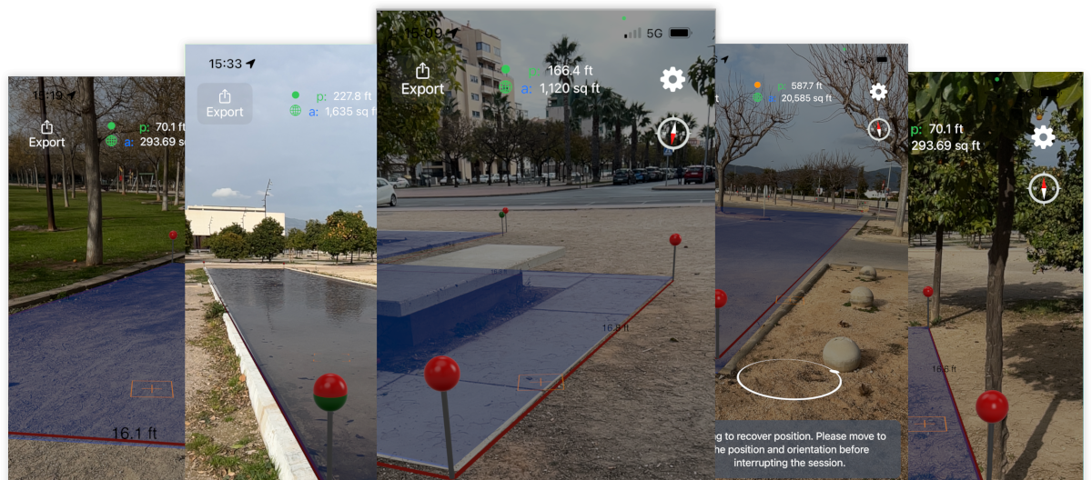
Select 3D to measure perimeters, intermediate distances or areas in 3D. Or 2D to ge the projected distances or areas over the horizontal plane.
Pins can be moved simply by dragging them to adjust their position with more precision. Or they can be deleted by tapping on them.
Undo or redo cactions like Add / Delete or Move.
Export your measurements to Measure Map Pro to work with geopositioned measurements over Google or Apple Maps. Adjust rotation or position as needed.
Select between a wide variety of measurement units (metric or imperial). Choose colors, transparency, decimals, etc ...
Test all the functionality for a Month. Or forever during a limited period of time.
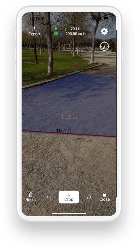
Turn your device a bit to both sides and down to learn the environment until the small circle and the world icons turn green. That is the best state to start measuring.
Point with the square crosshair to the place you want to drop a pin. It will detect the horizontal planes. Then walk and drop pins to draw the perimiter you want to measure. Drop as many pins as you need.
Press the "Close" button to finish and close the polygon by placing a pin on the position of the first one.
Press the export button to send the measurements to Measure Map Pro. You will be able to rotate and move the polygon to precisely place it on Google or Apple Maps.
This app is awesome. I can measure gardening areas in a matter of minutes just with my iPhone. I export it to Measure Map Pro and can create a project and an estimate in a moment, on the site, with my clients. This is a game changer. There are other apps that involve purchasing expensive GPS devices that get worse accuracy than this app.

I am a real estate agent and use this app to measure areas, like backyards, pools, porches. This is the perfect complement of Measure Map Pro.

Get Measure Map AR and begin testing it for free. You will not be disappointed.